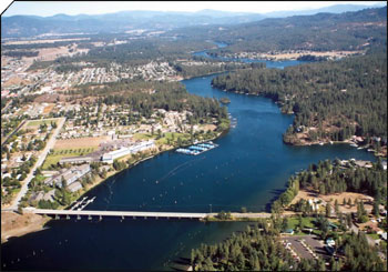
City in Idaho, United States
Post Falls
Long cold season, with most rain falls in winter. Winter is not just a brief interruption. Noticeable daylight swing. Snow is a real part of winter.
About Post Falls
Post Falls is a city in Kootenai County, Idaho, United States. It is the gateway city to Northern Idaho off Interstate 90, just west of Coeur d'Alene, and east of Spokane, Washington. The population is an estimated 44,194 in 2022 according to the U.S. Census Bureau estimate, making it Idaho's ninth-largest city and the second largest city in North Idaho behind Coeur d’Alene.Wikipedia
See how Post Falls stacks up before you commit.
Find practical next steps in Post Falls.
Housing, movers, and local services for people who are past browsing and starting to plan.
Where It Is
State Context
IdahoU.S. stateIdaho is a landlocked state in the Pacific Northwest and Mountain West subregions of the Western United States. It borders Montana and Wyoming to the east, Nevada and Utah to the south, and Washington and Oregon to the west; the state shares a small portion of the Canada–United States border to the north with the Canadian province of British Columbia. Idaho's state capital and largest city is Boise. With an area of 83,569 square miles (216,440 km2), Idaho is the 14th-largest state by land area.Wikipedia
About the Region
Mountain WestThe Mountain West has experienced one of the most dramatic demographic transformations of any American region over the past fifteen years. Colorado's Front Range — Fort Collins through Denver to Colorado Springs — has absorbed hundreds of thousands of new residents drawn by mountain access and a strong multi-sector economy across aerospace, energy, biotech, and tech. Salt Lake City's startup ecosystem has grown quietly into one of the most productive per-capita in the country. Boise and Missoula have emerged from obscurity into genuine destination cities.
The cost of this transformation has been housing. Denver and Bozeman have seen appreciation that rivals coastal markets, driven by limited developable land, in-migration pressure, and the sustained appeal of ski slope and trailhead access. Montana, Wyoming, and Idaho retain large stretches of genuine affordability and open space — but tradeoffs include isolation, limited rural healthcare, and economies still dependent on extractive industries. Wildfire risk, driven by worsening drought cycles, is an increasingly material homebuying consideration across the entire region.
Nature Access
Closest protected landscapes, reserves, and big park systems surfaced from the same nearby feeds used in compare.
Federal Park Sites
Local Nature & Reserves
City Profile
Cost of Living
Livability
Climate
Comfort combines temperature band fit, humidity fit, seasonal swing, and penalties for long stretches of extreme heat or cold. Higher scores mean the yearly pattern stays closer to an easier day-to-day climate band.
Natural Hazard Risk
Current Conditions
Local Next Steps
Housing and local help for a move to Post Falls
Real estate, rentals, moving help, and everyday local businesses for people taking a serious look at Post Falls. Sponsored placements are clearly labeled and never influence the city data.
Keep Exploring
Featured In Collections
Discovery Lenses

Compare Post Falls with other cities
Stack it side-by-side against cities you're considering.