Unincorporated community in Maryland, United States
Clinton
Weather & Forecast
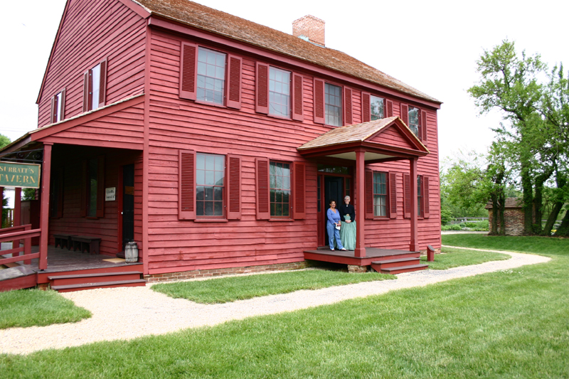
Clinton is an unincorporated census-designated place (CDP) in Prince George's County, Maryland, United States. Clinton was formerly known as Surrattsville until after the time of the Civil War, and Robeystown from 1865 to 1878. The population of Clinton was 38,760 at the 2020 census. Clinton is historically known for its role in the American Civil War concerning the Abraham Lincoln assassination. Clinton is adjacent to Camp Springs, Rosaryville, Melwood, and Andrews Air Force Base.Wikipedia
Temperatures vary across four distinct seasons. Rain falls fairly evenly through the year. Spring and fall feel like real transition seasons. Annual snowfall is between 5 and 15 inches. Humidity stays elevated through most of the year.
See how Clinton stacks up before you commit.
Find practical next steps in Clinton.
Housing, movers, and local services for people who are past browsing and starting to plan.
Where It Is
State Context
MarylandU.S. stateMaryland is a state in the Mid-Atlantic and Southeastern regions of the United States. It borders Virginia to its south, West Virginia to its west, Pennsylvania to its north, and Delaware to its east, as well as with the Atlantic Ocean to its east, and the national capital and federal district of Washington, D.C. to the southwest. With a total area of 12,407 square miles (32,130 km2), Maryland is the ninth-smallest state by land area, and its population of 6.1 million ranks it the 19th-most populous state and the fifth-most densely populated.Wikipedia
About the Region
Mid-AtlanticThe Mid-Atlantic includes the urban corridor through New York City, Philadelphia, Baltimore, and Washington, D.C., as well as rural areas, mountains, and smaller communities outside that corridor. A city in this region does not necessarily share the density or transport connections of those major centers.
Coastal, inland, and upland locations have different weather and travel patterns. Regional rail connections and walkable neighborhoods are location-specific, while housing costs depend on the local market. Compare the city figures and investigate the particular neighborhood before choosing a place.
Nearby Parks & Nature
Closest protected landscapes, reserves, and big park systems surfaced from the same nearby feeds used in compare.
Federal Park Sites
Local Nature & Reserves
Housing Costs & Income
Livability
Mostly car-oriented day to day.
Climate Through the Year
Annual average of days with more than five hours of sunshine, not necessarily clear skies.
Comfort combines temperature band fit, humidity fit, seasonal swing, and penalties for long stretches of extreme heat or cold. Higher scores mean the yearly pattern stays closer to an easier day-to-day climate band.
Local Next Steps
Housing and local help for a move to Clinton
Real estate, rentals, moving help, and everyday local businesses for people taking a serious look at Clinton. Sponsored placements are clearly labeled and never influence the city data.
Compare Clinton with other cities
Stack it side-by-side against cities you're considering.