
City in California, United States
Santa Barbara
Warm most of the year, with most rain falls in winter. True cold stays fairly limited. Rain is less frequent but tends to come in heavier bursts. Humidity stays fairly steady through the year.
About Santa Barbara
Santa Barbara is a coastal city in Santa Barbara County, California, of which it is also the county seat. Situated on a south-facing section of coastline, the longest such section on the West Coast of the United States excepting Alaska, the city lies between the steeply rising Santa Ynez Mountains and the Pacific Ocean. Santa Barbara's climate is often described as Mediterranean, and the city has been dubbed "The American Riviera". As of the 2020 census, Santa Barbara had a population of 88,665.Wikipedia
Where It Is
State Context
CaliforniaU.S. stateCalifornia is a U.S. state in the Western United States that lies on the Pacific Coast. It borders Oregon to the north, and Nevada and Arizona to the east; it also shares an international border with the Mexican state of Baja California to the south. With over 39 million residents across an area of 163,696 square miles (423,970 km2), it is the largest U.S.Wikipedia
About the Region
CaliforniaCalifornia contains multitudes in a way that makes any single characterization misleading. The Bay Area and Los Angeles operate as global city-states, with housing markets, income levels, and cultural gravity that put them in direct competition with London and Tokyo rather than with other American metros. Both have lost net domestic migrants to lower-cost states for most of the last decade — primarily to Texas, Arizona, and Nevada — though both also continue to be net draws for international migration and maintain labor markets of extraordinary depth and diversity.
But California's geography is vast. The Central Valley offers costs of living that rival the Midwest with driving distance to the Sierra Nevada; the North Coast is one of the most beautiful and least-crowded stretches of American coastline; and the smaller cities of the inland valleys represent genuinely different lifestyle profiles. For remote workers who can absorb the state income tax and housing cost, the combination of climate diversity, outdoor access, and cultural institution density remains difficult to replicate anywhere in the world.
Nature Access
Closest protected landscapes, reserves, and big park systems surfaced from the same nearby feeds used in compare.
Federal Park Sites
Local Nature & Reserves
City Profile
Cost of Living
Livability
Climate
Comfort combines temperature band fit, humidity fit, seasonal swing, and penalties for long stretches of extreme heat or cold. Higher scores mean the yearly pattern stays closer to an easier day-to-day climate band.
Natural Hazard Risk
Current Conditions
Local Next Steps
Useful local connections for a move to Santa Barbara
Housing, moving help, and everyday local businesses for people taking a serious look at Santa Barbara. Sponsored placements are clearly labeled and never influence the city data.
Keep Exploring
Featured In Collections
Discovery Lenses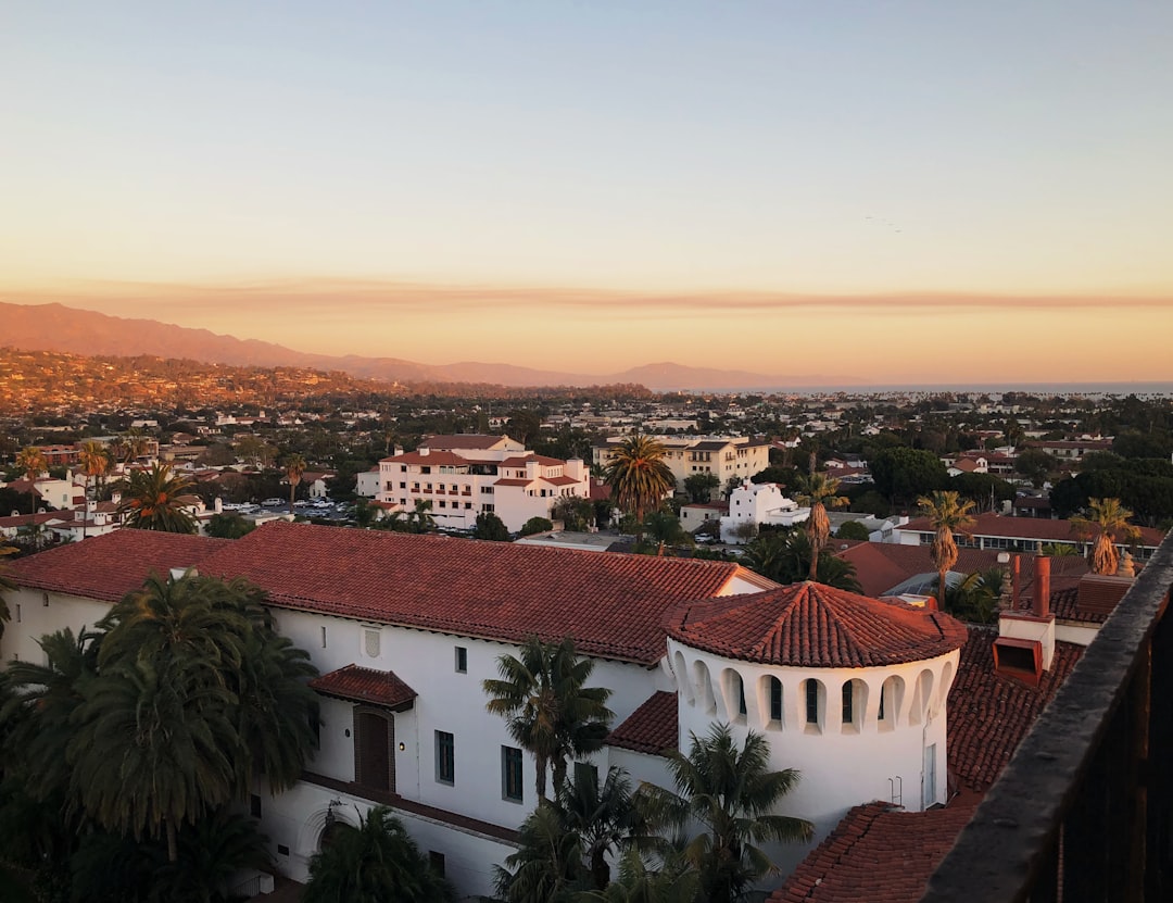
Compare Santa Barbara with other cities
Stack it side-by-side against cities you're considering.